
Move From a Jackson County Address to a Record
Start with the Assessor's linked Beacon real-estate route. That is the path when a Jackson County situs address is what you hold. If the search returns a parcel, save the details exactly as displayed. Copy the map, district, parcel, sub-parcel, and legal description. Beacon sits behind a paywall on that path. Its exact field labels, required inputs, result limits, and image access stay unverified until you open it live. Another county's Beacon site may use a field Jackson County's does not. So trust only the fields you see.
- Enter the known address through the Assessor's real-estate link and check whether it identifies a parcel.
- Copy the owner name, mailing and situs addresses, map reference, and legal description only when the card displays them.
- Use the party name and description with the County Clerk's recording records to locate a deed or related filing.
- Use the Sheriff's tax search to check a tax ticket by taxpayer, account, ticket, or district-map-parcel key.
- Compare the parcel in Beacon and any recorded plat, then ask the office for a copy when a result needs proof.
Jackson County Beacon Fields Need a Live Check
The Assessor's public real-estate page links to Schneider Beacon. It shows guidance rather than a live search form. The page itself carries no sample parcel card. So the current layout stays unknown until you run a search. Owner-name lookup appears to be available through the linked Real Estate Search. Address formats, parcel matching, pagination, and image fees remain unverified for the same reason. Open the official guidance first. Then check the real fields in a browser or at the Assessor counter. The Jackson County Assessor real-estate page explains the office's role, tax maps, and GIS. It is guidance, though, not a record result. So it does not confirm the present card layout.
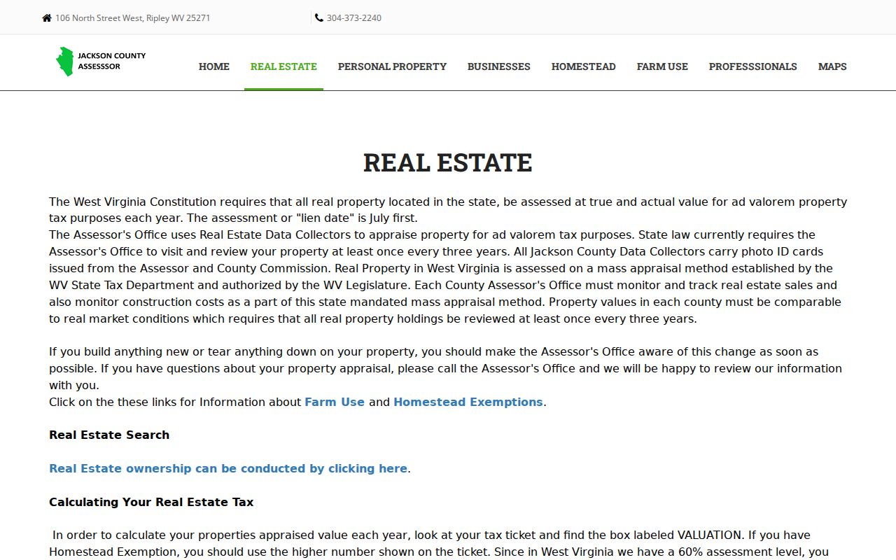
Follow that county link to reach the search. Then note which fields actually appear before you lean on any result.
The Jackson County Sheriff Search Adds a Ticket Key
Tax status lives apart from the owner and value roll. The Sheriff's site accepts a taxpayer name, an account number, a year-ticket-suffix combination, or a district-map-parcel-sub-parcel combination. Tax-year, real-versus-personal, and paid-or-unpaid filters are also offered, and the captured Jackson County field inventory is:
| Field group | Input | Use and limits |
|---|---|---|
| Taxpayer Name (last, first) | Text | Enter surname before given name |
| Taxpayer Account Number | Text | Direct account lookup |
| Tax Year, Ticket, Suffix | Text fields | Use together for a ticket reference |
| District, Map, Parcel, Sub-Parcel | Dropdowns | Option values and exact parcel syntax were not captured |
| Tax Year / Real-Personal / Paid-Unpaid | Filters | Site options should be checked live |
The result is a Sheriff tax record, not proof of ownership. The site says the display reflects its own database and disclaims reliance on it. Confirm any payment or delinquency question with the office at 304-373-2280.
What to Save From a Jackson County Parcel Card
No sample card appears in the public materials. Treat these items as a checklist to compare against the live record. Check the tax year and source shown with each result before you rely on any field.
| Owner and mailing | Copy the name and mailing address only as displayed; the mailing address can differ from the property site. |
|---|---|
| Parcel reference | Save district, map, parcel, and sub-parcel labels to carry into the tax-ticket search. |
| Legal description | Preserve lot and block or metes-and-bounds text for the deed and plat comparison. |
| Value and class | Check land, improvement, assessed value, exemptions, classification, and tax year if shown. |
| Sale and map links | Record a displayed sale date or deed citation, sketch, GIS link, or value history without assuming all are present. |
What a Jackson County Search Result Can Carry Forward
The most useful Jackson County property search result is the set of keys that moves you to the next custodian. No live Assessor card appears in the public materials. So these are field groups to verify in person. They are not guaranteed screen labels.
| Owner name | Check the exact displayed owner of record; an entity or estate name may not identify a natural person. |
|---|---|
| Situs and mailing | Keep the physical property address separate from the owner's tax-mail address. |
| District, map, parcel | Use the Assessor's exact labels in the Sheriff's tax lookup; parcel syntax was not captured. |
| Value and class | Verify the tax year, assessment class, exemption, and any land or improvement breakdown shown. |
| Legal description | Carry the full description into Clerk deeds and recorded plats. |
| Sale reference | If present, save date, consideration, and deed citation for verification in the Clerk record. |
A result is a pointer, not a promise. Liens, estate claims, boundary details, and unrecorded interests may not appear there at all. Confirm ownership with the newest recorded deed, and use a survey for any boundary question.
Keep Jackson County Mailing and Situs Addresses Apart
The situs address identifies the taxable land or building. The mailing address tells where the tax notice goes. They can differ for a rural tract, an entity, an estate, or anyone who receives mail elsewhere. A postal city name does not prove the property sits inside a municipal boundary either. When a modern street address fails to match an older deed, fall back on the legal description and parcel reference. The Clerk's record may describe lot and block. It may use metes and bounds, or it may list an older road name. Compare that text against the plat and the Assessor map before treating two entries as the same land. The Jackson County parcel map page covers map limits and tax-map copies.
Jackson County's Roll Can Trail a New Deed
The Assessor updates values annually. The office also reviews real estate in person at least once every three years. The lien date is July 1. Those rules set the assessment schedule. County pages do not state how many days after recording a transfer the owner field changes, though. A deed recorded after the roll's working cutoff may be newer than the screen. Use the newest deed as the next check whenever a recent purchase, estate transfer, or entity conveyance conflicts with the Assessor. The Clerk publishes no online index start year. So ask about coverage before concluding a deed is absent. The deed search notes explain the Clerk's public categories and copy route.
City Permit Files Add Jackson County Context
A building or code question may live in a separate city file. Ripley City Hall can be asked about a permit or code record. Supply the address, time span, and parcel description. Ripley publishes no online property-permit search. Ravenswood posts a Forms & Permits page. Its exact search fields, fees, and coverage stay unstated. A city request supplements the county search. It does not replace the Assessor parcel or the Clerk deed. Give the city the street address, owner or project name, permit type, and year range if known. The record may not be online. Ask whether paper files sit at City Hall. Also ask what copy process applies.
Jackson County Search Fallbacks When a Link Fails
A public records portal can block certain sessions, and a web host sometimes closes a connection before a page loads. That says nothing about daily access for residents. Open the official link directly. Call the office if a form is down. The courthouse counter can also settle an index question in person.
For historic deeds, the State Archives holds an 1831-1968 deed index, deeds from 1836-1901, surveys from 1831-1890, and plat books from 1859-1939. The Jackson County Library offers genealogy and history links, and the Historical Society handles obituary research. These are leads, not deed substitutes.
Choose the Right Jackson County Search Key
Address is the easiest first input. Owner name helps when the person or entity is already known. A parcel reference is strongest once the Assessor has identified it. The parcel number ties every deed record and tax bill to one lot. A good Jackson County property search often uses all three in sequence. It rarely forces one key into every portal.
| Search Key | Best For | Where It Works | Watch Out |
|---|---|---|---|
| Address / situs | Locate a known property or city permit file | Assessor link, Beacon, and city offices | Address, postal city, and municipal line can differ |
| Owner name | Find an owner entry or deed party | Assessor's linked search and Clerk index | Use spelling, entity, trust, and estate variants |
| District / map / parcel | Match a tax ticket to a parcel | Assessor, Beacon, and Sheriff's ticket search | Copy local labels; exact syntax was not captured |
Not a title search. A Jackson County property search helps find public entries, but it does not establish clear title or every interest in land. Use recorded documents and qualified title review for a purchase or legal claim.
Save Jackson County Search Keys With the Date
A useful search note records more than the first result link. Write down the date you searched. Include the address as entered and the parcel or map key shown. Add the tax year attached to any value or ticket. Copy the owner spelling exactly, including any estate or company suffix. Keep the legal description beside it. Mark a field as unavailable if it does not appear. Never fill it from another source. This gives the Clerk or Assessor a precise starting point. A later search can produce a different result.
For a tax question, carry the district, map, parcel, sub-parcel, and ticket components into the Sheriff's search. For a transfer question, take the owner names and land description to the County Clerk. The tax ticket and deed are different records. They can concern the same lot. The saved date also explains a mismatch. A newer filing or a later assessment cycle can be the cause.
Jackson County Search Help at the Assessor’s Office
An address can return no result. It can also return several possible parcels. Contact the Assessor with the street address, the owner spelling if known, and a nearby road or landmark. Include any tax bill or deed reference you have. The office sits at 106 North Street West in Ripley, phone 304-373-2240. Published hours run Monday through Friday, 8:30 a.m. to 4:30 p.m., closed noon to 1 p.m. Staff can explain the county's map key. They will also make a current-year photocopy of a tax map as a courtesy.
When the question is whether an instrument was recorded, contact the County Clerk at 100 Court Street North, 304-373-2200. Give the parties, the approximate date, and the land description. Ask what index and image access are available. A tax payment problem belongs to the Sheriff, 304-373-2280. Each question should go to the office that maintains the record. No single portal is a complete property history.
Search Jackson County Records With an Owner Name
A name is a fine start. It works when the address is old, rural, or uncertain. The Assessor's public real-estate page links to an owner search. The form does not publish its exact fields or match rules. Enter the spelling from a tax notice or deed. Compare each account to the parcel description. For a business, estate, or trust, keep the full legal name and any suffix. Never shorten it to a person's surname.
The Sheriff's tax form uses taxpayer name in last-name-first format. It also accepts an account or ticket reference. It finds a tax account, not a title owner. The County Clerk's public record pages list document types and copy information but not the index's party-search fields. If a name search misses a deed, ask whether the Clerk searches grantor, grantee, both, or an older index series. A similar name in another record is no match. Confirm it with the land description, and keep the county and time period clear.